Show summary Hide summary
- Where Hurricane Polo is now and how fast it grew
- US Embassy issues urgent travel advisory — what it says
- How Los Cabos and Baja California Sur are likely to be affected
- Port closures, marina instructions, and beach safety measures
- What travelers should expect for flights, tours, and resort stays
- Immediate steps travelers should take today
- Timing and short-term outlook for conditions
- Where to get official updates and travel alerts
If your travel plans include the Mexican Pacific coast or the Baja Peninsula this weekend, pause and read this now. A rapidly intensifying storm named Hurricane Polo has become a major threat, and authorities are already warning tourists and residents to prepare for dangerous surf, heavy rain, and travel disruptions.
Where Hurricane Polo is now and how fast it grew
Forecasters report Hurricane Polo strengthened rapidly over unusually warm waters. It has reached Category 5 strength, with sustained winds estimated near 165 mph (265 km/h). The center sits well offshore, roughly 335 km south of Zihuatanejo, but the storm’s influence stretches far beyond the eye.
Taylor Swift: are we over her now that her love story is complete?
Jaime King and Austin Sosa divorced after secret whirlwind marriage: split leaves them blindsided
The system is producing heavy rain across southwestern states, including Colima, Michoacán, Guerrero, and Oaxaca. Meteorologists expect Polo to track northwest along the Pacific coast over the coming days. Even with the eye staying offshore, the hurricane’s broad circulation is driving powerful surf and storm bands up the coastline.
US Embassy issues urgent travel advisory — what it says
The United States Embassy and consulates in Mexico issued an urgent alert for U.S. citizens in affected areas. The advisory emphasizes that, although a direct landfall is not certain, the storm poses multiple hazards across the Pacific Coast and Baja Peninsula.
- Avoid the water: Embassy officials warn that rip currents and rogue waves will be deadly. Do not swim or walk on exposed beaches during the event.
- Flood and landslide risk: Heavy rain may cause flash flooding and mudslides in mountainous zones.
- Follow local orders: Monitor local media, adhere to instructions from Mexican authorities, and review road and shelter conditions before traveling.
How Los Cabos and Baja California Sur are likely to be affected
Models show Polo weakening before it approaches Baja California Sur. By Sunday, September 27, forecasts indicate the hurricane may drop to Category 3 strength near its closest point to Cabo San Lucas.
Even if the storm center remains hundreds of kilometers offshore, Cabo and nearby resort areas can expect:
- Heavy rainfall and localized flooding
- Strong, gusty winds
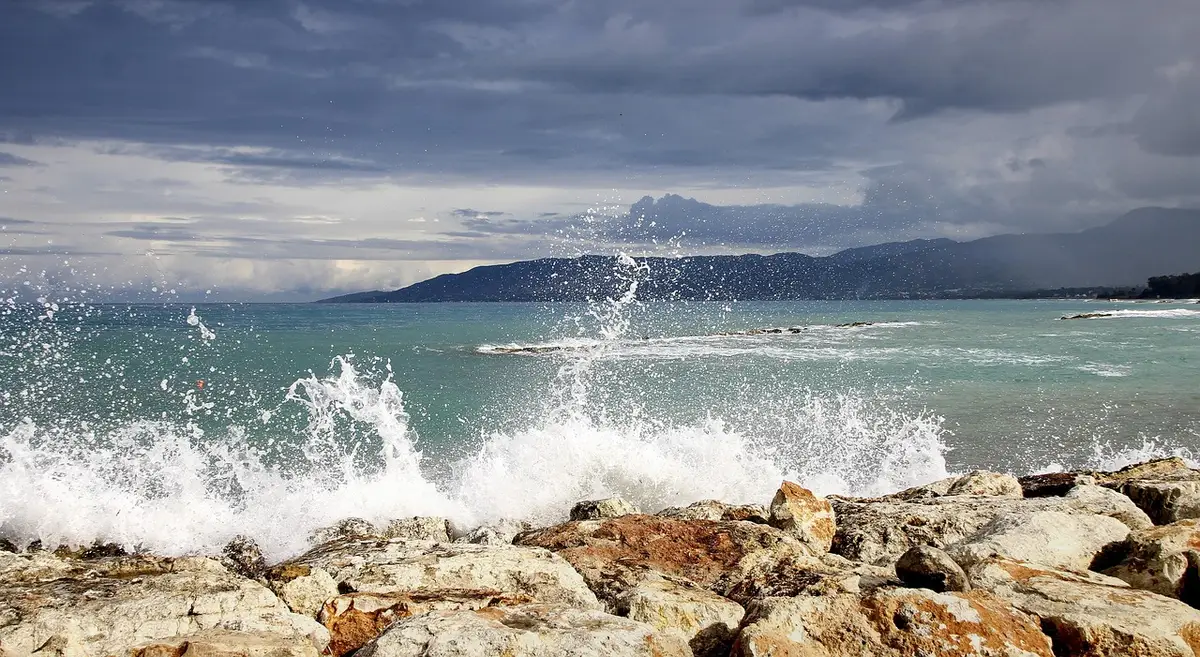
- Very large ocean swells and dangerous surf
Forecasters estimate the closest pass could be about 370 km southwest of Cabo San Lucas. That distance may sound large, but the storm’s massive size means its outer bands will still deliver hazardous conditions to the region.
Port closures, marina instructions, and beach safety measures
To reduce risk at sea, Mexican authorities have moved quickly. The Mexican Navy issued maritime advisories, and officials announced port closures for small vessels starting at midnight Wednesday in Cabo San Lucas.

Local actions already in effect or likely to be enforced include:
- Cancellation of recreational sea tours, sunset cruises, snorkeling, and fishing charters.
- Orders for light vessels to be removed from the water and for larger boats to seek shelter inside safe harbors.
- Removal of safety buoys and placement of solid red flags on public beaches.
- Securement of beachfront furniture and outdoor equipment at hotels, beach clubs, and restaurants.
A solid red flag means swimming is prohibited. Do not enter the ocean while warnings remain active.
What travelers should expect for flights, tours, and resort stays
Airports often remain open unless crosswinds or debris create unsafe conditions. Still, travelers should prepare for schedule changes.
- Flights: Check with your airline frequently. Expect delays or cancellations as carriers adjust schedules.
- Activities: All water-based excursions will likely be canceled during dangerous conditions.
- Ground travel: Heavy rain and landslides can affect roads. Verify road status and plan alternate routes if needed.
- Resorts: Large hotels in Los Cabos are typically built to withstand hurricane conditions. Staff are trained for emergency operations.
Pack essentials, keep digital and physical copies of travel documents, and prepare for possible indoor-only days.
Immediate steps travelers should take today
If you are in or traveling to affected zones, take these actions now:
- Contact your airline to confirm your flight status and ask about waiver or rebooking policies.
- Register with the U.S. Embassy or enroll in your government’s traveler alert system for updates.
- Keep a battery-powered radio or charged phone for local emergency bulletins.
- Secure outdoor items, follow hotel guidance, and know your resort’s shelter plan.
- Do not enter the water under any official beach closure or red-flag condition.
Stay flexible. Changing forecasts can alter impacts and timelines. Prioritize safety over schedules.
Timing and short-term outlook for conditions
Meteorologists expect Polo to weaken as it moves north, but intensity forecasts can shift quickly. The storm should begin to lose strength before reaching Baja, yet coastal impacts will continue while the system is nearby.
Key timing notes
- Current position: far offshore but moving northwest.
- Possible closest approach to Baja: late week into the weekend.
- High surf and hazardous coastal conditions: ongoing while the hurricane tracks northward.
Monitor official weather products from national meteorological services and the U.S. Embassy for the latest timing and hazard details.
Where to get official updates and travel alerts
For authoritative guidance, check these sources regularly:
- Your airline or travel provider for schedule changes.
- Mexican civil protection agencies and local authorities for evacuation or port advisories.
- The U.S. Embassy and consulates in Mexico for alerts aimed at American citizens.
- National weather services and regional hurricane centers for forecast updates.
Do not rely solely on social media. Confirm orders and warnings through official channels before making choices that affect safety.